BBN Routes & Projects
better bike network concept map
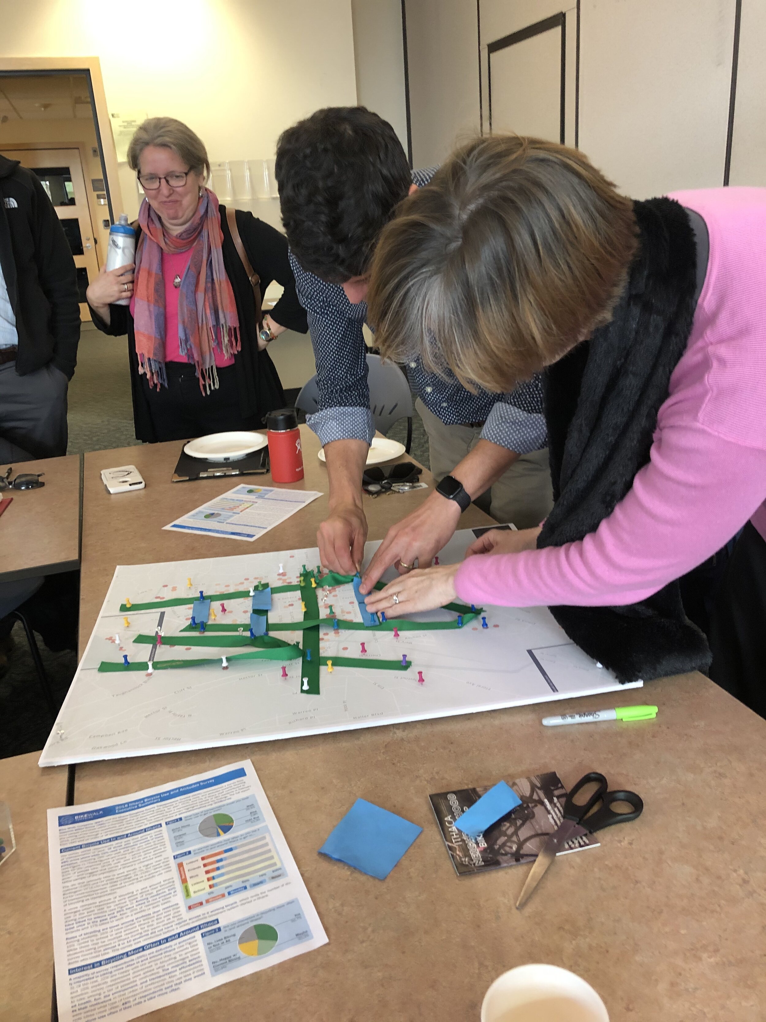
We collaborated with representatives of municipalities and relevant stakeholders to map out a Better Bike Network that’s convenient, connected, safe, and comfortable for everyone in and around Ithaca. We used survey and bikeshare use data and followed the prescribed guidelines for a Better Bike Network. The network is composed of two sections, one in the flats of Ithaca and the other connecting the urban and suburban municipalities on East Hill. Here’s how we’ll make it happen, together.
Local Stakeholders
City of Ithaca
Cornell University
Ithaca-Tompkins County Transportation Council
Tompkins County (county routes)
Town of Ithaca
Town of Lansing
NYS Department of Transportation (state routes)
Village of Cayuga Heights
Village of Lansing
The proposal includes two networks – Ithaca’s Flats and East Hill – to recognize the different centers of activity between key locations throughout the urban, suburban, and collegiate neighborhoods in and around Ithaca.

Ithaca’s Flats
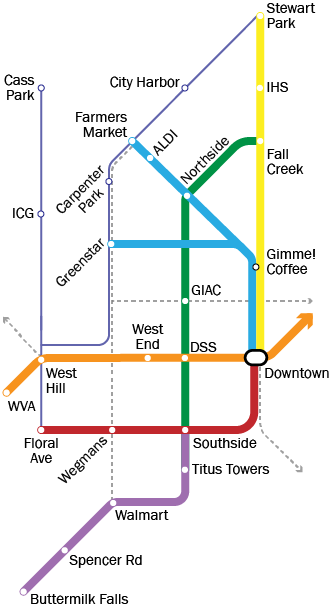
better bike network routes

The Better Bike Network is presented in a simplified “subway-style” map to show how neighborhoods and destinations should be connected together. Explore how the Better Bike Network could be realized on Ithaca’s existing streets by reading more about your favorite route!
The flats of Ithaca lie in a basin at the end of Cayuga Lake. The gentle terrain and concentration of common destinations make it an ideal place for people who are new to bicycling.
Six Better Bike Routes will transform our disconnected bike map into a functional network, helping more residents feel comfortable traveling to work, school, shop, dine, and play by bicycle.
Go with your family to catch a lakefront sunset at Stewart Park, or just admire the orange glow as you bike home from work or school along the leafy streets of Fall Creek.
Grab your tote bags and take your friends who are here visiting out to the Ithaca Farmers’ Market the stress-free way, or just go to the new Greenstar for local produce any day of the week.
Take your little ones to school by bike or let them get to their afterschool program at Southside or GIAC by themselves along quiet neighborhood streets.
What seemed like Ithaca’s longest mile is now no more as your trip from West Hill to Downtown now takes less than 10 minutes along the most convenient bike lanes in Ithaca.
Stop to birdwatch on your way to the grocery store as you ride along the creek—or change your mind and save the shopping for later; your kid wants to see Gaia now!
You’ll want a bigger basket as the Walmart plaza and every shop along Elmira Rd is now a hop-and-a-skip away by bike, or just have lunch by Buttermilk Falls—now 10 minutes from downtown.
better bike network projects
A phased approach to infrastructure implementation will ensure that bare minimum Better Bike Network is established on Ithaca’s Flats by the end of Phase 1. A selection of Key Projects within Phase 1 allow for quick-build solutions that can be pilot tested or implemented now. Phase 2 rounds out the Better Bike Network with more route choices, creating a solid grid.
Existing Better Bike Network Routes
Phase 1 Better Bike Network Projects
Phase 2 Better Bike Network Projects
key projects
Widen and pave existing footpath from Spencer Rd to Buttermilk Falls State Park parking lot, complete with signage
Convene a taskforce between NYSDOT, Town of Ithaca, CWT, ICSD, and City of Ithaca. Upgrade gravel walkway to 11+ feet wide sidewalk, tighten all turning radii, and add lighting and public art where feasible.
Connect Wegmans driveway to S Plain St with protected bike lane or shared use trail. Improve safety by adding signal priority and diverter at Meadow St. Repave parts of S Plain St.
Repave Adams and Madison Streets after utility trenching damage plus wear and tear, and repaint bicycle boulevard road markings to improve visibility of route.
Repave bike boulevards to provide a safe riding surface
Improve safety at these Route 13 intersections by adding bike/ped signal priority, tightening turning radii, and hardening medians. Consider protected bicycle crossing at Third St due to heavy bike and pedestrian flows during market hours.
Pilot test a two-way protected bike lane on north side of Cascadilla St from Cayuga St to the new Greenstar, keeping in mind complex turning needs at Cayuga St and Northside-Southside route intersections.
Convert one lane of Plain St bridge into plaza over creek with benches, trail info, public art, and add a cycle track along plaza curbside.
Pilot test protected bike lane (either two-way or one on each side) and improve connection to IHS-Boynton Trail.
Simplify and make safer connections between W MLK Jr and Hector St bike lanes to CWT, BDT extension, and potential Elm St bike lane (Project D1). Add wayfinding signage to make these connections even more visible.
Build two-way cycle track from Walmart to Meadow St. using one lane.
Chip seal or repave Plain St along most of this stretch. Improve intersection safety by adding diverters, painted bicycle lanes, and traffic signals where needed.
Connect Downtown to West End with protected lanes or two-way cycle track. Remove double-yellow line and use parked vehicles to buffer bike lanes.
Add diverters to encourage vehicles to use Albany and Cayuga Streets for thru-traffic. Create 11+ foot wide shared-use trail along creekside.
Upgrade bike lanes on Elmira Road to protected bike lanes or two-way cycle track from Plain St. to S Meadow St. Continue protected lanes across crosswalk at Meadow St., onto existing parklet by gas station, and to Meadow St.
Build a roundabout at Lewis St. Build and diverters at Farm St and Tompkins St to lower vehicle speeds to 20 mph and stop thru-traffic.
Conduct a study focused on connecting the Fall Creeker, Waterfront Connector, Hill-to-Hill, and Six Mile Creek Trail together on existing downtown streets. Pilot test allowing slow bicycling (10 mph or less) along center of the Commons.
phase 1 projects
Conduct study to determine how to serve southern West Hill residential areas with bike infrastructure, in particular West Village Apartments.
Add painted or buffered bike lanes depending on traffic flow levels after implementing traffic calming measures at crossings (Project C3).
Create shared-use paths connecting Spencer Rd to Rt 13 every 800 feet (two city blocks); use vacant lots next to Honda and U-Haul property
Repave Spencer Rd from S Meadow St to Salvation Army exit and enhance family-friendly feel of neighborhood by traffic calming road to 10 mph using chicanes, paving elements, and vegetation
Create safe passageway from Meadow St to Plain St along Titus Towers property and NYSEG utility corridor
Expand public access to Cayuga Waterfront Trail by building a bike/ped railroad crossing at Cascadilla St and formalizing the crossing at Court St.
Build bridge over flood control channel, and extend existing wide sidewalk near Nate’s Floral Estates to new bridge and Wegmans
Formalize shortcut and link to rehabilitated bridge
Implement changes planned by the City of Ithaca in 2018
Add a bike lane in preparation for the expected increase in vehicle traffic due to new Tompkins County office building.
Paint bike lanes to provide safer access from the Tioga St Bike Blvd to Ithaca Falls, Ithaca High School, and the Farmers Market (via the CWT).
Improve wayfinding on ICSD property and add additional sidewalk north of parking lot to connect with East Shore Drive and Project A1.
phase 2 projects
Upgrade existing bike lane to a protected or raised bike lane due to heavy traffic flows
Pilot test protected bike lane from Cascadilla St to CWT trailhead at the Ithaca Farmers Market to increase safety during peak hours and market days.
Extent Cayuga St protected bike lanes from downtown to connect separate portions of Six Mile Creek trail and the Chainworks redevelopment.
Paint bike lane connecting Cayuga Waterfront Trail to University Ave uphill bike lane for confident bicycle users
Test allowing bicycling on Meadow and Fulton Street sidewalks
Protect existing bike lanes or combine into two-way cycle track on northbound side.


